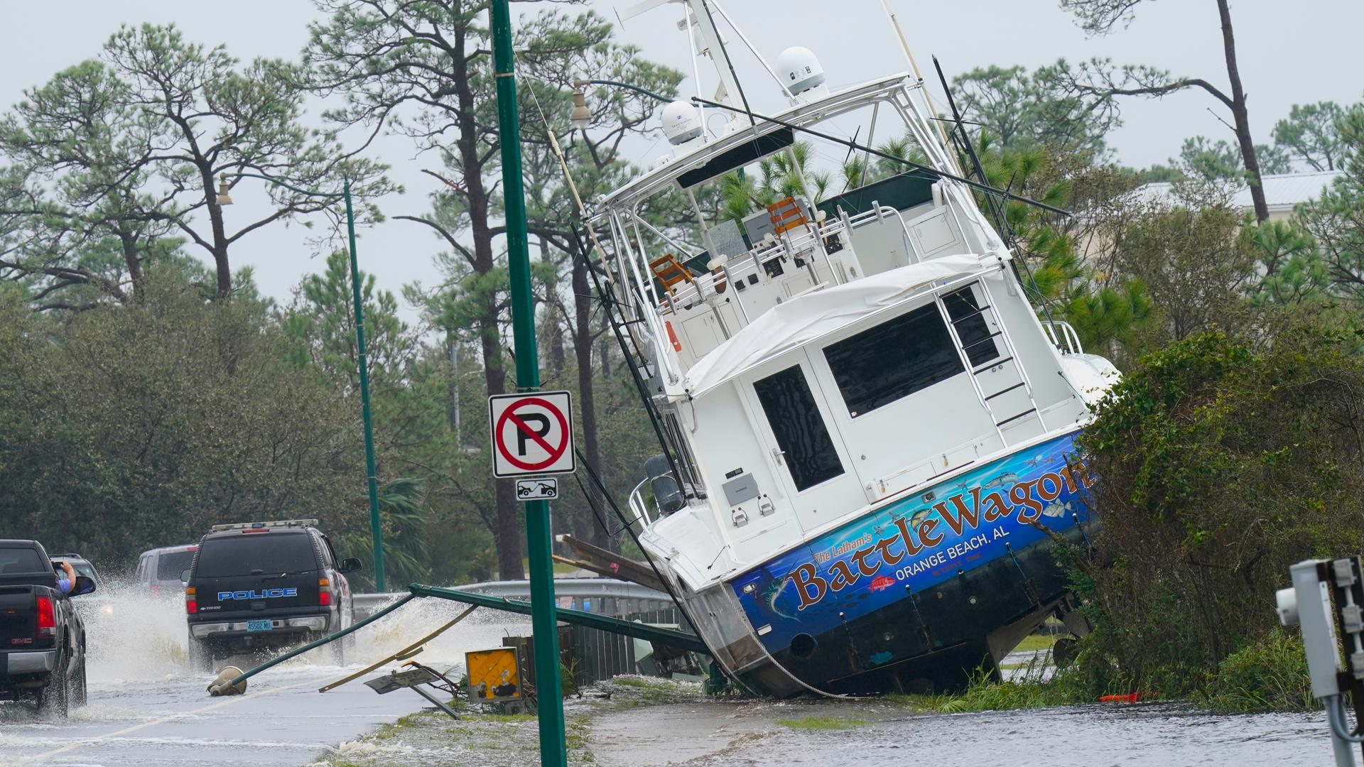
Sally has weakened into a tropical storm, although catastrophic and life-threatening flooding continued to occur over portions of the Florida Panhandle and southern Alabama, the US National Hurricane Center (NHC) said.
The storm was located about 45 km (30 miles) north-northeast of Pensacola, Florida, packing maximum sustained winds of 110 kilometres per hour (70 miles per hour), the NHC said.
“Additional weakening is expected as the centre moves farther inland this afternoon and tonight, and Sally is forecast to become a tropical depression by Thursday morning,” the Miami-based weather forecaster added.
#Sally has weakened into a tropical storm. It continues to spread torrential rain across AL and FL with flash flood emergencies in place due to quickly rising water. #BeOn4 @WWLTV pic.twitter.com/UNtFb3tHi5
— Dave Nussbaum (@Dave_Nussbaum) September 16, 2020
Still dealing with high surge this afternoon along our coast from Baldwin County eastward through Okaloosa County. This is Escambia Bay in Milton off of Avalon Blvd.
Video from Asheley Singleton @NWSMobile
— Thomas Geboy (@ThomasGeboyWX) September 16, 2020
#Sally pic.twitter.com/EsWdwVKWWj
Massive devastation
Sally’s northern eyewall had raked the Gulf Coast with hurricane-force winds and rain from Pensacola Beach, Florida, westward to Dauphin Island, Alabama, for hours before its centre finally hit land.
Trees were bending over and flailing around in the howling winds in downtown Pensacola, where driving rain flooded streets up to the bumpers of parked cars. In downtown Mobile, Alabama, a street light snapped, swinging wildly on its cable.
Nearly 400,000 homes and businesses had lost electricity by early Wednesday, according to the poweroutage.us site. A curfew was called in Gulf Shores due to life-threatening conditions. In the Panhandle’s Escambia County, Chief Sheriff’s Deputy Chip Simmons vowed to keep deputies out helping residents as long as physically possible.
The county includes Pensacola, one of the largest cities on the Gulf Coast.
“The sheriff’s office will be there until we can no longer safely be out there, and then and only then will we pull our deputies in,” Simmons said at a storm briefing late Tuesday.
This for a storm that, during the weekend, appeared to be headed for New Orleans. “Obviously this shows what we’ve known for a long time with storms – they are unpredictable,” Pensacola Mayor Grover Robinson IV said.
READ MORE: Climate warning: World’s largest wetland in Brazil is burning
Downtown Pensacola is UNDERWATER @weatherchannel @NWSMobile @cityofpensacola #Hurricane #sally #Florida pic.twitter.com/P0xgBo4joD
— Chris Bruin (@TWCChrisBruin) September 16, 2020
Palafox and Main. One of the higher points. #stormsurge Pensacola, FL. #Sally pic.twitter.com/o4S7VJJvVm
— Jim Cantore (@JimCantore) September 16, 2020
Catastrophic rainfall
Stacy Stewart, a senior specialist with the hurricane center, told The Associated Press said the rainfall will be “catastrophic and life threatening” over portions of the Gulf Coast, Florida panhandle and southeastern Alabama, and will continue well after landfall, with the storm producing heavy rainfall Wednesday night and Thursday over portions of central and southern Georgia.
Sally was a rare storm that could make history, said Ed Rappaport, deputy director of the hurricane center.
“Sally has a characteristic that isn’t often seen and that’s a slow forward speed and that’s going to exacerbate the flooding,” Rappaport told the AP.
He likened the storm’s slow progression to that of Hurricane Harvey, which swamped Houston in 2017. Up to 30 inches of rain could fall in some spots, and “that would be record-setting in some locations,” Rappaport said in an interview Tuesday night.
Sally’s impact was felt all along the northern Gulf Coast. Low lying properties in southeast Louisiana were swamped by the surge. Water covered Mississippi beaches and parts of the highway that runs parallel to them. Two large casino boats broke loose from a dock where they were undergoing construction work in Alabama.
READ MORE: Deaths as Tropical storm Isaias lashes US east coast
Flash floods
Mississippi Governor Tate Reeves urged people in the southern part of his state to prepare for flash flooding.
As Sally’s outer bands reached the Gulf Coast, the manager of an alligator ranch in Moss Point, Mississippi, was hoping he wouldn’t see a repeat of what happened at the gator farm in 2005, when about 250 alligators escaped their enclosures during Hurricane Katrina’s storm surge.
Gulf Coast Gator Ranch & Tours Manager Tim Parker says Sally has been a stressful storm because forecasters were predicting a storm surge of as much as 9 feet in his area. He felt some relief after surge predictions shifted.
Sally was forecast to bring heavy downpours to parts of Mississippi, Alabama, Georgia and the Carolinas later in the week.
Some inland residents weren’t waiting, driving to the coast to experience Sally’s power before it hit land.
With heavy rains pelting Navarre Beach, Fla., and the wind-whipped surf pounding, a steady stream of people walked down the wooden boardwalk at a park for a look at the scene Tuesday afternoon.
READ MORE: Hurricane Laura weakens after ‘catastrophic’ landfall in southern US


Discussion about this post